Mapping Honduras' water supply

In Tegucigalpa and surrounding areas, Hondurans often wait weeks for tap water to flow.
A new study, designed and co-authored by Ricardo Sánchez-Murillo, associate professor of earth and environmental sciences at The University of Texas at Arlington, could change that.
In a region highly vulnerable to climate change and climate variability, Honduras' water sources are also burdened by rapid population growth, increased land use and extreme weather events. A lack of historical hydro-meteorological data has limited the government's knowledge of where, when and how the nation's water supply recharges.
"Water availability is one of Honduras' most challenging public services," Sánchez-Murillo said. "During prolonged dry seasons, many people must resort to buying expensive bottled water or water imported from other basins."
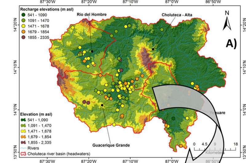
To seek solutions, Sánchez-Murillo and an international team of researchers have spent the last three years tracing Tegucigalpa's water supply from rainstorm to faucet. They monitored rainfall at various elevations and collected precipitation samples from groundwater and surface water sources, including springs, drilled wells, boreholes and streams. Using this data, they created mathematical models to understand at which locations the water is recharged, which occurs when rainwater is absorbed by aquifers following storms.
This allowed them to produce detailed maps of water sources in the Choluteca River basin, charting for the first time geographic areas integral to water recharge for municipal water regulation, protection and conservation.
The team's findings, reported in the journal Science of the Total Environment, show that areas critical to recharge are currently stressed by agricultural land use, deforestation and forest degradation caused by an invasive insect.
Equipped with this information, Sánchez-Murillo and colleagues have been translating their maps for Honduran authorities and recommending stricter urbanization and agriculture regulations to conserve water and protect vital landscapes.
In his native country of Costa Rica, the government pays landowners a stipend per hectare to comply with conservation practices, Sánchez-Murillo said. Agreements like that help guarantee consistent environmental services and groundwater recharge.
By providing data and guidance to water resource managers, Sánchez-Murillo hopes to improve the quality of life for residents of central Honduras.
"At this time, many people are choosing to leave the country as part of climate-induced migrations in search of stable resources," Sánchez-Murillo said. "Together, we can solve this problem, improve people's lives and provide a sustainable home."
More information: S. García-Santos et al, Water stable isotopes reveal a complex rainfall to groundwater connectivity in central Honduras, Science of The Total Environment (2022). DOI: 10.1016/j.scitotenv.2022.156941
Journal information: Science of the Total Environment
Provided by University of Texas at Arlington


